Difference between revisions of "Atameng"
Jump to navigation
Jump to search
Litrobotix (talk | contribs) (updated) |
Litrobotix (talk | contribs) (updated languages) |
||
| Line 28: | Line 28: | ||
|official_languages = [[Amakane_language|Amakane]] | |official_languages = [[Amakane_language|Amakane]] | ||
|national_languages = <!--Country/territory-wide languages recognised but not necessarily in country/territory-wide law, etc--> | |national_languages = <!--Country/territory-wide languages recognised but not necessarily in country/territory-wide law, etc--> | ||
|regional_languages = [[Osveraali_language|Osveraali]], [[ | |regional_languages = [[Osveraali_language|Osveraali]], [[Lyladnese_language|Lyladnese]] | ||
|languages_type = <!--Use to specify a further type of language, if not official, national or regional--> | |languages_type = <!--Use to specify a further type of language, if not official, national or regional--> | ||
|languages = <!--Languages of the further type--> | |languages = <!--Languages of the further type--> | ||
Revision as of 16:10, 30 October 2018
| The Chiefdom of Atameng A Ean Supi an Atameng |
||||||
|---|---|---|---|---|---|---|
|
||||||
| Motto: A miwo pingem | ||||||
| Anthem: A muros an Supi | ||||||
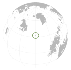
Location of Atameng in Asuranesia
|
||||||
| Capital and | Omaki | |||||
| Official languages | Amakane | |||||
| Recognised regional languages | Osveraali, Lyladnese | |||||
| Ethnic groups (2010) | 85% Atamengian 15% Other |
|||||
| Demonym | Atamengian | |||||
| Government | Representative chiefdom | |||||
| - | High Chief | Sotihao | ||||
| Legislature | Tirutung | |||||
| Establishment | ||||||
| - | Loose confederation of city-states | 900 | ||||
| - | Unification of city-states and formation of representative chiefdom | 1809 | ||||
| Area | ||||||
| - | 15,220 km2 5,876 sq mi |
|||||
| Population | ||||||
| - | 2018 estimate | 1.5 million | ||||
| - | Density | 98.5/km2 255.2/sq mi |
||||
| Gini | 0.3 low · 2010 |
|||||
| HDI (2010) | 0.848 very high |
|||||
| Currency | Atamengian Teho (ATT) | |||||
| Date format | dd-mm-yyyy CE | |||||
| Drives on the | left | |||||
| Calling code | +683 | |||||
| Internet TLD | .at | |||||
Atameng (Amakane: Atameng [atamɛŋ]), officially the Chiefdom of Atameng, is is an island nation in Atsiq in the Jaxukuk Sea comprising three islands - Itepu, Etukong, and Kupara. Atameng's closest neighbors are Dachashk and Shalorja to the north, Astalva to the east, and Jilu Lyladna to the west.


