File:HemberdoriaMap.png
Revision as of 02:06, 18 June 2018 by Astrangemann (talk | contribs) (The political map of Hemberdoria)
No higher resolution available.
HemberdoriaMap.png (240 × 166 pixels, file size: 8 KB, MIME type: image/png)
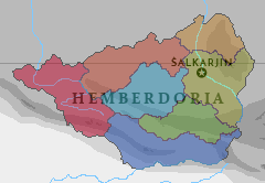
The political map of Hemberdoria
File history
Click on a date/time to view the file as it appeared at that time.
| Date/Time | Thumbnail | Dimensions | User | Comment | |
|---|---|---|---|---|---|
| current | 02:06, 18 June 2018 | | 240 × 166 (8 KB) | Astrangemann (talk | contribs) | The political map of Hemberdoria |
You cannot overwrite this file.
File usage
There are no pages that use this file.