Difference between revisions of "File:Jute map bigger changed terrain labeled improved colors.png"
Jump to navigation
Jump to search
m |
(Jute uploaded a new version of File:Jute map bigger changed terrain labeled improved colors.png) |
||
| (2 intermediate revisions by the same user not shown) | |||
| Line 1: | Line 1: | ||
Map of Jute, showing the biggest cities, rivers and mountain ranges | Map of Jute, showing the biggest cities, rivers and mountain ranges | ||
[[Category:Maps of | Lighter green represents grassland or fields, darker green tropical forest. | ||
[[Category:Maps of Jute]] | |||
Latest revision as of 00:27, 23 February 2022
Map of Jute, showing the biggest cities, rivers and mountain ranges Lighter green represents grassland or fields, darker green tropical forest.
File history
Click on a date/time to view the file as it appeared at that time.
| Date/Time | Thumbnail | Dimensions | User | Comment | |
|---|---|---|---|---|---|
| current | 00:27, 23 February 2022 |  | 1,512 × 1,060 (179 KB) | Jute (talk | contribs) | Island names added |
| 15:27, 11 March 2020 | 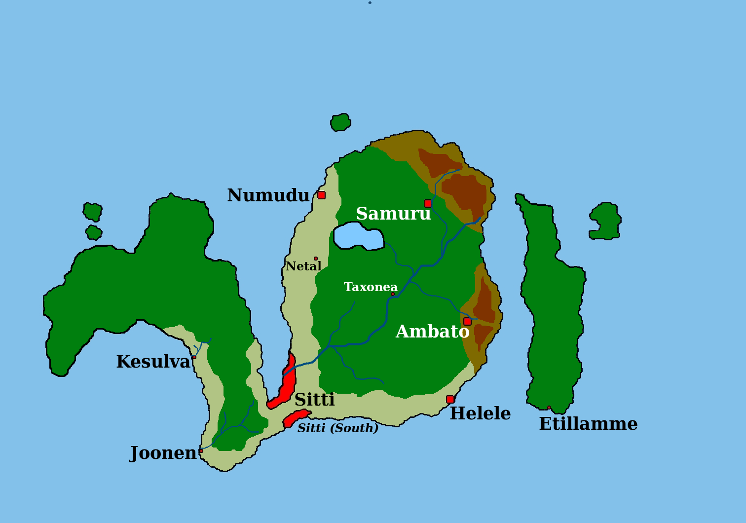 | 1,512 × 1,060 (163 KB) | Jute (talk | contribs) | ||
| 18:40, 20 February 2020 |  | 1,512 × 1,060 (163 KB) | Jute (talk | contribs) | Map of Jute, showing the biggest cities, rivers and mountain ranges Category:ImagesCategory:MapsCategory:JuteCategory:Ystel |
You cannot overwrite this file.
File usage
The following page uses this file: