Difference between revisions of "File:Jute map bigger changed terrain labeled improved colors with railways.png"
Jump to navigation
Jump to search
(Categories) |
m |
||
| Line 1: | Line 1: | ||
Map of Jute, showing the biggest cities, railways, rivers and mountain ranges | Map of Jute, showing the biggest cities, railways, rivers and mountain ranges | ||
[[Category:Images]][[Category:Maps]][[Category:Jute]][[Category:Ystel]] | [[Category:Images]][[Category:Maps]][[Category:Jute]][[Category:Ystel]][[Category:Railway maps]] | ||
Revision as of 18:40, 20 February 2020
Map of Jute, showing the biggest cities, railways, rivers and mountain ranges
File history
Click on a date/time to view the file as it appeared at that time.
| Date/Time | Thumbnail | Dimensions | User | Comment | |
|---|---|---|---|---|---|
| current | 09:52, 24 April 2021 |  | 1,512 × 1,060 (169 KB) | Jute (talk | contribs) | Colors improved again, railways updated |
| 22:50, 19 February 2020 | 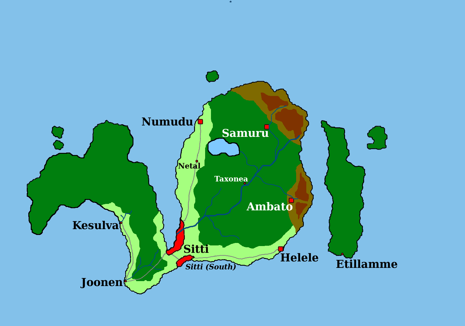 | 1,512 × 1,060 (171 KB) | Jute (talk | contribs) | Map of Jute, showing the biggest cities, railways, rivers and mountain ranges |
You cannot overwrite this file.
File usage
The following page uses this file: