Difference between revisions of "File:South Jute, based on Curlie's map, administrative divisions.png"
Jump to navigation
Jump to search
m |
m |
||
| (5 intermediate revisions by the same user not shown) | |||
| Line 1: | Line 1: | ||
Map of South Jute, based on a map of Curlie on CWS, showing administrative divisions and the most important towns, paths and the railway | Map of South Jute, based on a map of Curlie on CWS, showing administrative divisions and the most important towns, paths and the railway | ||
[[Category: | |||
[[Category:Maps of Ystel]] [[Category:Maps of administrative divisions]] [[Category:South Jute]] | |||
Latest revision as of 20:22, 25 June 2021
Map of South Jute, based on a map of Curlie on CWS, showing administrative divisions and the most important towns, paths and the railway
File history
Click on a date/time to view the file as it appeared at that time.
| Date/Time | Thumbnail | Dimensions | User | Comment | |
|---|---|---|---|---|---|
| current | 00:48, 20 February 2020 | 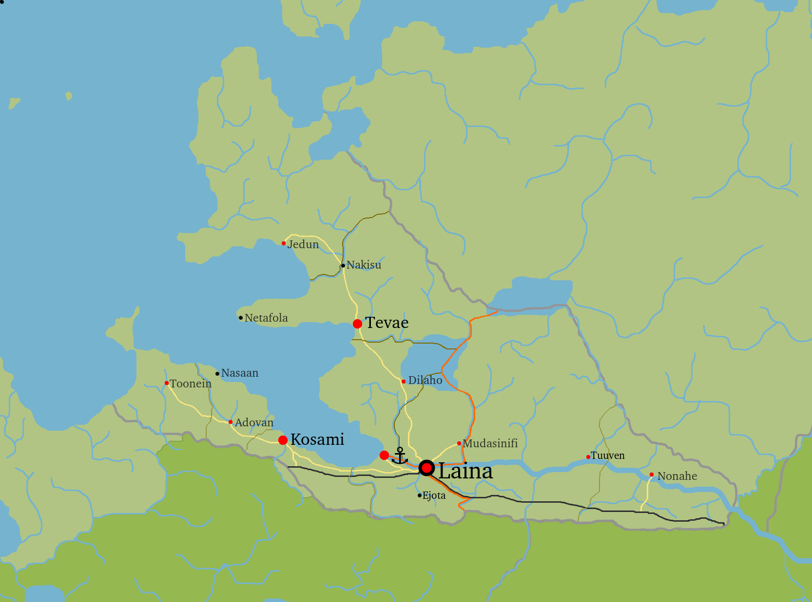 | 1,666 × 1,237 (169 KB) | Jute (talk | contribs) | Map of South Jute, based on a map of Curlie on CWS, showing administrative divisions and the most important towns, paths and the railway Category:ImagesCategory:MapsCategory:JuteCategory:YstelCategory:Administrative Divisions |
You cannot overwrite this file.
File usage
There are no pages that use this file.