File:UrbDTmap.png
Jump to navigation
Jump to search

Size of this preview: 750 × 600 pixels. Other resolutions: 2,560 × 2,048 pixels | 3,750 × 3,000 pixels.
Original file (3,750 × 3,000 pixels, file size: 882 KB, MIME type: image/png)
Summary
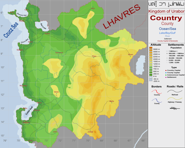
Topographic and updated city location map, with demarcation of Rails and Roads
File history
Click on a date/time to view the file as it appeared at that time.
| Date/Time | Thumbnail | Dimensions | User | Comment | |
|---|---|---|---|---|---|
| current | 21:30, 16 January 2024 | | 3,750 × 3,000 (882 KB) | Baermey (talk | contribs) | fixed sizing.... again |
| 21:27, 16 January 2024 | Error creating thumbnail: File with dimensions greater than 12.5 MP | 4,000 × 3,200 (894 KB) | Baermey (talk | contribs) | fixed sizing | |
| 21:24, 16 January 2024 | 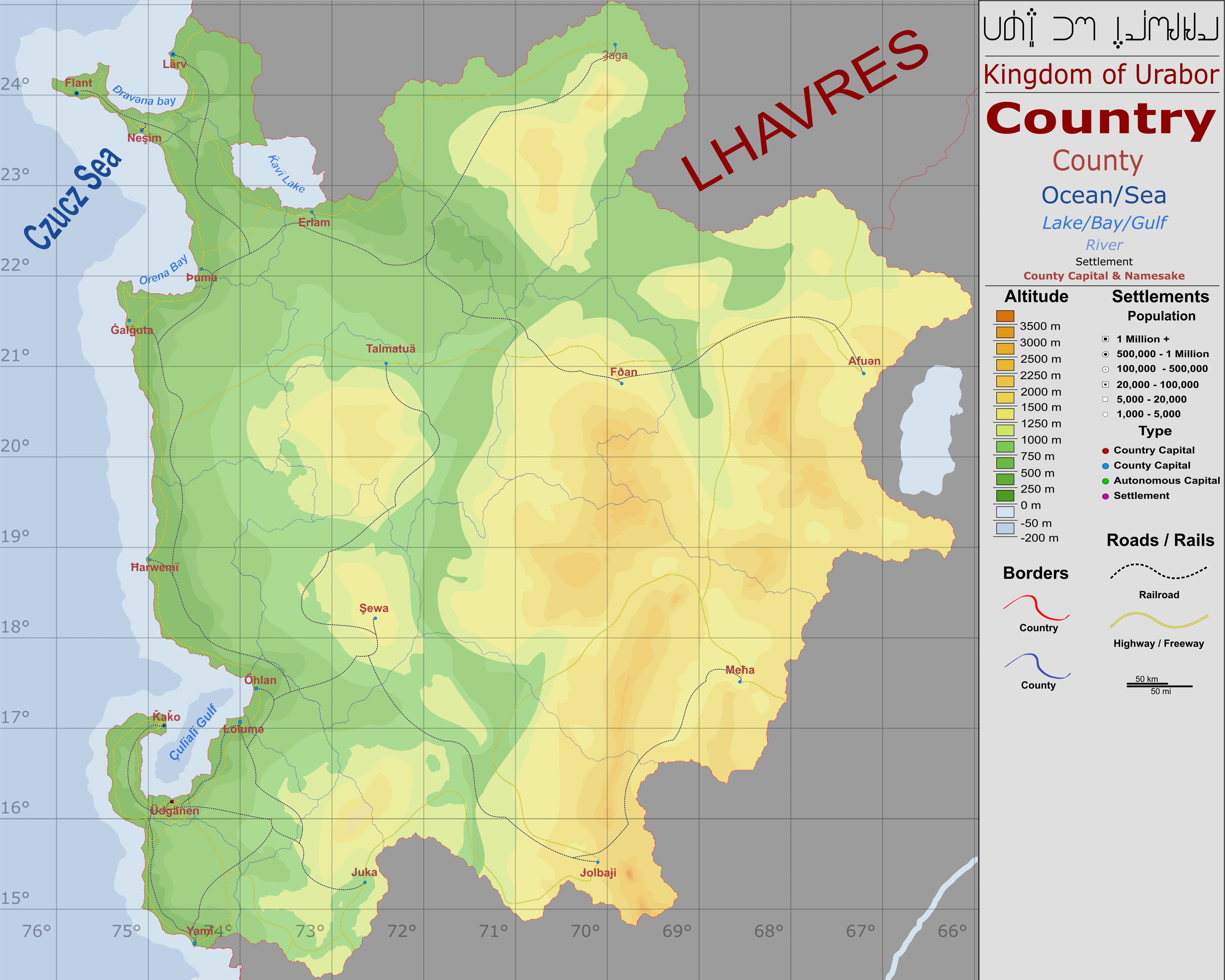 | 3,750 × 3,000 (3.38 MB) | Baermey (talk | contribs) | Reverted to version as of 04:18, 14 July 2022 (UTC) | |
| 21:22, 16 January 2024 | Error creating thumbnail: File with dimensions greater than 12.5 MP | 10,630 × 8,504 (2.39 MB) | Baermey (talk | contribs) | updated lat | |
| 21:22, 16 January 2024 | Error creating thumbnail: File with dimensions greater than 12.5 MP | 21,260 × 17,008 (5.44 MB) | Baermey (talk | contribs) | updated lat | |
| 04:18, 14 July 2022 |  | 3,750 × 3,000 (3.38 MB) | Baermey (talk | contribs) | Topographic and updated city location map, with demarcation of Rails and Roads |
You cannot overwrite this file.
File usage
The following page uses this file: