Difference between revisions of "Khambvan"
Jump to navigation
Jump to search
(Redirected page to Zwazwamia) |
|||
| (4 intermediate revisions by one other user not shown) | |||
| Line 1: | Line 1: | ||
#REDIRECT [[Zwazwamia]] | |||
{{Infobox country | {{Infobox country | ||
|conventional_long_name = | |conventional_long_name = Holy Priestdom of Khambvan | ||
|native_name = <!--Country's name (usually full name) in its native language, hence in italics (double quotemarks)--> | |native_name = <!--Country's name (usually full name) in its native language, hence in italics (double quotemarks)--> | ||
|common_name = | |common_name = Khambvan | ||
|image_flag = | |image_flag = Khambvan_flag.png | ||
|alt_flag = <!--alt text for flag (text shown when pointer hovers over flag)--> | |alt_flag = <!--alt text for flag (text shown when pointer hovers over flag)--> | ||
|image_flag2 = <!--e.g. Second-flag of country.svg--> | |image_flag2 = <!--e.g. Second-flag of country.svg--> | ||
| Line 15: | Line 16: | ||
|other_symbol_type = <!--Use if a further symbol exists, e.g. hymn--> | |other_symbol_type = <!--Use if a further symbol exists, e.g. hymn--> | ||
|other_symbol = | |other_symbol = | ||
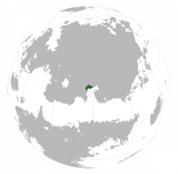
|image_map = | |image_map = Locator_globe_Khambvan.png | ||
|alt_map = <!--alt text for map--> | |alt_map = <!--alt text for map--> | ||
|map_caption = <!--Caption to place below map--> | |map_caption = <!--Caption to place below map--> | ||
| Line 21: | Line 22: | ||
|alt_map2 = <!--alt text for second map--> | |alt_map2 = <!--alt text for second map--> | ||
|map_caption2 = <!--Caption to place below second map--> | |map_caption2 = <!--Caption to place below second map--> | ||
|capital = | |capital = Arzing | ||
|latd= | latm= | latNS= |longd= |longm= |longEW= <!--capital's latitude and longitude in degrees/minutes/direction--> | |latd= | latm= | latNS= |longd= |longm= |longEW= <!--capital's latitude and longitude in degrees/minutes/direction--> | ||
|largest_city = | |largest_city = capital | ||
|largest_settlement_type = | |largest_settlement_type = largest city | ||
|largest_settlement = <!--Name of largest settlement--> | |largest_settlement = <!--Name of largest settlement--> | ||
|official_languages = <!--Languages recognised in legislation, constitution, etc--> | |official_languages = Khamv<!--Languages recognised in legislation, constitution, etc--> | ||
|national_languages = <!--Country/territory-wide languages recognised but not necessarily in country/territory-wide law, etc--> | |national_languages = <!--Country/territory-wide languages recognised but not necessarily in country/territory-wide law, etc--> | ||
|regional_languages = <!--Languages recognised or associated with particular regions within the country/territory--> | |regional_languages = <!--Languages recognised or associated with particular regions within the country/territory--> | ||
| Line 117: | Line 118: | ||
}} | }} | ||
'''Khambvan''' (IPA: //, Native language: ''Country'', IPA: //), officially the ''' | '''Khambvan''' (IPA: /ˈkɑmvɑn/, Native language: ''Country'', IPA: //), officially the '''Holy Priestdom of Khambvan''', is a country located in eastern Vaniua, bordered by Amaia to the north, Balakia to the west, and the (something) Gulf to the south. ... <!-- add the country's geographic location, name its neighbours (if any) --> <!--Briefly present the country in terms of history, language, politics, something the country is well-known for. --> | ||
==Etymology== | ==Etymology== | ||
Latest revision as of 10:23, 18 October 2018
Redirect to:
| Holy Priestdom of Khambvan |
||||
|---|---|---|---|---|
|
||||
| Capital and largest city | Arzing | |||
| Official languages | Khamv | |||
Khambvan (IPA: /ˈkɑmvɑn/, Native language: Country, IPA: //), officially the Holy Priestdom of Khambvan, is a country located in eastern Vaniua, bordered by Amaia to the north, Balakia to the west, and the (something) Gulf to the south. ...

