Difference between revisions of "Komania"
Jump to navigation
Jump to search
| Line 1: | Line 1: | ||
{{Infobox country | {{Infobox country | ||
|conventional_long_name = The Kajamate of Komania | |conventional_long_name = The Kajamate of Komania | ||
|native_name = | |native_name = [[Koman language|Koman]]: Kālyāghālëm Kāşurāh <br>[[Mishar language|Mishar]]: Gálákál Dotö | ||
|common_name = Komania | |common_name = Komania | ||
|image_flag = Koman flag.png | |image_flag = Koman flag.png | ||
| Line 14: | Line 14: | ||
|other_symbol_type = <!--Use if a further symbol exists, e.g. hymn--> | |other_symbol_type = <!--Use if a further symbol exists, e.g. hymn--> | ||
|other_symbol = | |other_symbol = | ||
|image_map = | |image_map = Komania location.png | ||
|alt_map = <!--alt text for map--> | |alt_map = <!--alt text for map--> | ||
|map_caption = <!--Caption to place below map--> | |map_caption = <!--Caption to place below map--> | ||
Revision as of 17:06, 10 May 2017
| The Kajamate of Komania |
||||||
|---|---|---|---|---|---|---|
|
||||||
| Motto: Jabav Thagha şāgha nom şüghāş Let god be my eyes |
||||||
| Anthem: Āthān Bivı Golden song |
||||||
| Capital | Jānvān | |||||
| Largest city | Sāmādar | |||||
| Ethnic groups | Koman (89 %) Other (11 %) |
|||||
| Demonym | Koman | |||||
| Government | Constitutional Monarchy | |||||
| - | Kājäm (emperor) | Mijanli Āşar | ||||
| - | Prime minister | Dāmäka Bāşak | ||||
| Legislature | State Kojeh | |||||
| Establishment | ||||||
| - | Kali Tribal Confederation | |||||
| - | Kalkali Kajamate | 700-1352 | ||||
| - | Sunrise Horde | 1359-? | ||||
| - | Great Horde | 1378- 1622 | ||||
| - | Koman Kajamate | 1624 | ||||
| Area | ||||||
| - | 814.130 km2 314 sq mi |
|||||
| Population | ||||||
| - | 2016 estimate | 42,904,651 | ||||
| - | Density | 52.7/km2 136.5/sq mi |
||||
| Gini | 46 high |
|||||
| HDI (2016) | 0.786 high |
|||||
| Currency | Dahaz Dīnar | |||||
| Time zone | SCT +3 | |||||
| - | Summer (DST) | not observed (SCT) | ||||
| Drives on the | right | |||||
| Internet TLD | .DK | |||||
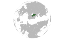
Komania (Koman IPA: /kɒljɒʁɒ̌ləm/) is a country in Vaniu bordered by Sotanxina by the west, Dohjan to the North and Raštun to the South.


