Difference between revisions of "Komania"
Jump to navigation
Jump to search
| Line 33: | Line 33: | ||
|ethnic_groups = Koman (89 %)<br>Other (11 %) | |ethnic_groups = Koman (89 %)<br>Other (11 %) | ||
|ethnic_groups_year = <!--Year of ethnic groups data (if provided) or use to place a <ref>--> | |ethnic_groups_year = <!--Year of ethnic groups data (if provided) or use to place a <ref>--> | ||
|religion = Thaghaism, Iovism | |||
|demonym = Koman | |demonym = Koman | ||
|government_type = Constitutional Monarchy | |government_type = Constitutional Monarchy | ||
Revision as of 20:42, 21 May 2017
| The Shavdom of Komania |
||||||
|---|---|---|---|---|---|---|
|
||||||
| Motto: Jabav Thağa şāğa nom şüğāş Let god be my eyes |
||||||
| Anthem: Āthān Bivı Golden song |
||||||
| Capital | Jānvān | |||||
| Largest city | Sāmādar | |||||
| Ethnic groups | Koman (89 %) Other (11 %) |
|||||
| Religion | Thaghaism, Iovism | |||||
| Demonym | Koman | |||||
| Government | Constitutional Monarchy | |||||
| - | Şav (emperor) | Mijanli Āşar | ||||
| - | Prime minister | Dāmäka Bāşak | ||||
| Legislature | State Assembly (Şur Kāhurvurë) | |||||
| Establishment | ||||||
| - | Kali Tribal Confederation | c.100 | ||||
| - | Kalkali Shavdom | 700-1352 | ||||
| - | Sunrise Horde | 1359-? | ||||
| - | Great Horde | 1378- 1622 | ||||
| - | Koman Shavdom | 1624 | ||||
| Area | ||||||
| - | 814.130 km2 314 sq mi |
|||||
| Population | ||||||
| - | 2016 estimate | 42,904,651 | ||||
| - | Density | 52.7/km2 136.5/sq mi |
||||
| Gini | 46 high |
|||||
| HDI (2016) | 0.786 high |
|||||
| Currency | Dahaz Dīnar | |||||
| Time zone | SCT +3 | |||||
| - | Summer (DST) | not observed (SCT) | ||||
| Drives on the | right | |||||
| Internet TLD | .DK | |||||
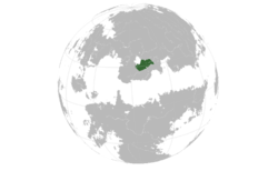
The Shavdom of Komania (Koman: -Kālyāğārëm.Kāşurāh-, Kālyāğārëm Kāşurāh; Mishar: Gálákál Sur-Gázuthö IPA: /kɒljɒʁɒ̌rəm/) is a country bordered by Sotanxina by the west, Dohjan to the North and Raštun to the South, located along the Melkanchuta lake on the Vaniuan region, the country shares


