Difference between revisions of "List of sovereign states and dependent territories in Boroso"
Jump to navigation
Jump to search
Aralxed777 (talk | contribs) |
|||
| Line 20: | Line 20: | ||
! style="font-weight: bold;" | Notes | ! style="font-weight: bold;" | Notes | ||
|- | |- | ||
| [[File:Bavkïrak_4.png|100px| | | [[File:Bavkïrak_4.png|100px|border|center]] | ||
| <!-- locator map --> | | <!-- locator map --> | ||
| [[Bavkïrak]]<br>The Royal Republic of the Bavkirs | | [[Bavkïrak]]<br>The Royal Republic of the Bavkirs | ||
| Line 29: | Line 29: | ||
| <!-- notes --> | | <!-- notes --> | ||
|- | |- | ||
| [[File:Dhwer_Flag_2.png|100px| | | [[File:Dhwer_Flag_2.png|100px|border|center]] | ||
| [[File:Dhwer_locator_map.png|150px|frameless|center]] | | [[File:Dhwer_locator_map.png|150px|frameless|center]] | ||
| [[Dhwer]]<br>United Kingdom of Dhwer and Penkrot | | [[Dhwer]]<br>United Kingdom of Dhwer and Penkrot | ||
| [[Dhwer language|Dhwer]]: | | [[Dhwer language|Dhwer]]: Ðwer bem Penkrut | ||
| [[KeHarl]] | | [[KeHarl]] | ||
| 21,334,000 | | 21,334,000 | ||
| Line 38: | Line 38: | ||
| <!-- notes --> | | <!-- notes --> | ||
|- | |- | ||
| [[File:Fadalh_flag.png|100px| | | [[File:Fadalh_flag.png|100px|border|center]] | ||
| <!-- locator map --> | | <!-- locator map --> | ||
| [[Fadalh]] | | [[Fadalh]] | ||
| Line 47: | Line 47: | ||
| <!-- notes --> | | <!-- notes --> | ||
|- | |- | ||
| [[File:FalsEmpireFlag1.png|100px| | | [[File:FalsEmpireFlag1.png|100px|border|center]] | ||
| <!-- locator map --> | | <!-- locator map --> | ||
| [[Fals Empire]] | | [[Fals Empire]] | ||
| Line 56: | Line 56: | ||
| <!-- notes --> | | <!-- notes --> | ||
|- | |- | ||
| <!--[[File:FILENAME.png|100px| | | <!--[[File:FILENAME.png|100px|border|center]]--> | ||
| <!-- locator map --> | | <!-- locator map --> | ||
| [[Heoroma]]<br>People's Republic of Heoroma | | [[Heoroma]]<br>People's Republic of Heoroma | ||
| Line 65: | Line 65: | ||
| <!-- notes --> | | <!-- notes --> | ||
|- | |- | ||
| <!--[[File:FILENAME|100px| | | <!--[[File:FILENAME|100px|border|center]]--> | ||
| <!-- locator map --> | | <!-- locator map --> | ||
| [[Khaazland]] | | [[Khaazland]] | ||
| Line 74: | Line 74: | ||
| <!-- notes --> | | <!-- notes --> | ||
|- | |- | ||
| [[File:Flag_of_Kuthaltum.png|100px| | | [[File:Flag_of_Kuthaltum.png|100px|border|center]] | ||
| <!-- locator map --> | | <!-- locator map --> | ||
| [[Kuthaltum]] | | [[Kuthaltum]] | ||
| Line 83: | Line 83: | ||
| <!-- notes --> | | <!-- notes --> | ||
|- | |- | ||
| [[File:LHA_Lhavres_Flag.png|100px| | | [[File:LHA_Lhavres_Flag.png|100px|border|center]] | ||
| <!-- locator map --> | | <!-- locator map --> | ||
| [[Lhavres]]<br>The Federal Republic of Lhavres | | [[Lhavres]]<br>The Federal Republic of Lhavres | ||
| Line 92: | Line 92: | ||
| <!-- notes --> | | <!-- notes --> | ||
|- | |- | ||
| <!--[[File:FILENAME|100px| | | <!--[[File:FILENAME|100px|border|center]]--> | ||
| <!-- locator map --> | | <!-- locator map --> | ||
| [[Lorz]] | | [[Lorz]] | ||
| Line 101: | Line 101: | ||
| <!-- notes --> | | <!-- notes --> | ||
|- | |- | ||
| [[File:Mbamigi flag.png|100px| | | [[File:Mbamigi flag.png|100px|border|center]] | ||
| [[File:Mbamigi_locator.png|150px|frameless|center]] | | [[File:Mbamigi_locator.png|150px|frameless|center]] | ||
| [[Mbamigi]]<br>Republic of the Mbamigi Islands | | [[Mbamigi]]<br>Republic of the Mbamigi Islands | ||
| Line 119: | Line 119: | ||
| <!-- notes --> | | <!-- notes --> | ||
|- | |- | ||
| <!--[[File:FILENAME|100px| | | <!--[[File:FILENAME|100px|border|center]]--> | ||
| <!-- locator map --> | | <!-- locator map --> | ||
| [[Ozuria]] | | [[Ozuria]] | ||
| Line 128: | Line 128: | ||
| <!-- notes --> | | <!-- notes --> | ||
|- | |- | ||
| [[File:Pthalk_Flag.png|100px| | | [[File:Pthalk_Flag.png|100px|border|center]] | ||
| <!-- locator map --> | | <!-- locator map --> | ||
| [[Pthalk]]<br>Joint Republic of Pthalk | | [[Pthalk]]<br>Joint Republic of Pthalk | ||
| Line 137: | Line 137: | ||
| <!-- notes --> | | <!-- notes --> | ||
|- | |- | ||
| [[File:Taanttu.png|100px| | | [[File:Taanttu.png|100px|border|center]] | ||
| <!-- locator map --> | | <!-- locator map --> | ||
| Republic of [[Taanttu]] | | Republic of [[Taanttu]] | ||
| Line 146: | Line 146: | ||
| <!-- notes --> | | <!-- notes --> | ||
|- | |- | ||
| [[File:Tuanmali_flag.png|100px| | | [[File:Tuanmali_flag.png|100px|border|center]] | ||
| <!-- map --> | | <!-- map --> | ||
| [[Tuanmali]]<br><small>Independent Union of Tuanmali Republics | | [[Tuanmali]]<br><small>Independent Union of Tuanmali Republics | ||
| Line 155: | Line 155: | ||
| <!-- notes --> | | <!-- notes --> | ||
|- | |- | ||
| [[File:UpperYaharaFlag.jpg|100px| | | [[File:UpperYaharaFlag.jpg|100px|border|center]] | ||
| <!-- locator map --> | | <!-- locator map --> | ||
| [[Upper Yahara]]<br>Kingdom of Yahara | | [[Upper Yahara]]<br>Kingdom of Yahara | ||
| Line 164: | Line 164: | ||
| <!-- notes --> | | <!-- notes --> | ||
|- | |- | ||
| [[File:Vaamekflag.png|100px| | | [[File:Vaamekflag.png|100px|border|center]] | ||
| <!-- locator map --> | | <!-- locator map --> | ||
| [[Vaamek]] <br> <small>United Republic of Vaamek</small> | | [[Vaamek]] <br> <small>United Republic of Vaamek</small> | ||
| Line 173: | Line 173: | ||
| <!-- notes --> | | <!-- notes --> | ||
|- | |- | ||
| [[File:Flag of Yaxarhayut.png|100px| | | [[File:Flag of Yaxarhayut.png|100px|border|center]] | ||
| <!-- locator map --> | | <!-- locator map --> | ||
| [[Yaxarhayut]] <br> <small>Kingdom of Yaxarhayut</small> | | [[Yaxarhayut]] <br> <small>Kingdom of Yaxarhayut</small> | ||
| Line 198: | Line 198: | ||
! style="font-weight: bold;" | Notes | ! style="font-weight: bold;" | Notes | ||
|- | |- | ||
| <!--[[File:FILENAME|100px| | | <!--[[File:FILENAME|100px|border|center]]--> | ||
| <!-- locator map --> | | <!-- locator map --> | ||
| [[Kunnordia]] | | [[Kunnordia]] | ||
| Line 208: | Line 208: | ||
| <!-- notes --> | | <!-- notes --> | ||
|- | |- | ||
| <!--[[File:FILENAME|100px| | | <!--[[File:FILENAME|100px|border|center]]--> | ||
| <!-- locator map --> | | <!-- locator map --> | ||
| [[Letzian Boroso]] | | [[Letzian Boroso]] | ||
| Line 218: | Line 218: | ||
| <!-- notes --> | | <!-- notes --> | ||
|- | |- | ||
| <!--[[File:FILENAME|100px| | | <!--[[File:FILENAME|100px|border|center]]--> | ||
| <!-- locator map --> | | <!-- locator map --> | ||
| [[Lorimer]] | | [[Lorimer]] | ||
| Line 228: | Line 228: | ||
| <!-- notes --> | | <!-- notes --> | ||
|- | |- | ||
| [[File:New_KeHarl_flag.png|100px| | | [[File:New_KeHarl_flag.png|100px|border|center]] | ||
| <!-- locator map --> | | <!-- locator map --> | ||
| [[Dhweran Overseas Territories#New KeHarl Island|New KeHarl Island]] | | [[Dhweran Overseas Territories#New KeHarl Island|New KeHarl Island]] | ||
| Line 238: | Line 238: | ||
| <!-- notes --> | | <!-- notes --> | ||
|- | |- | ||
| <!--[[File:FILENAME|100px| | | <!--[[File:FILENAME|100px|border|center]]--> | ||
| <!-- locator map --> | | <!-- locator map --> | ||
| [[Terminian Far West]] | | [[Terminian Far West]] | ||
Revision as of 03:45, 4 June 2016
The list below entails all fully and partially recognized states and territories in Boroso. There are currently at least 9 fully recognized territories within Boroso.
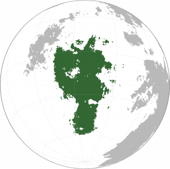
Definition of Boroso as a Continent
Countries and dependencies
Boroso is divided into at least eighteen sovereign countries and five dependencies.
Recognized states
| Flag | Map | Short and formal names | Domestic short and formal names | Capital | Population | Area | Notes |
|---|---|---|---|---|---|---|---|
| Bavkïrak The Royal Republic of the Bavkirs |
Taara: Bavkïrak Ta Humurï Bavkïridan Tǡdan |
Wuluuð Ça | 11,000,500 | ||||
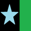
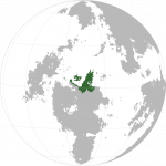
| Dhwer United Kingdom of Dhwer and Penkrot |
Dhwer: Ðwer bem Penkrut | KeHarl | 21,334,000 | ||||
| Fadalh | |||||||
| Fals Empire | Faljüdax: Kuulatir Fals | Ikolinis | 160,336,115 | 1,393,001 square kilometres (537,841 sq mi) | |||
| Heoroma People's Republic of Heoroma |
Heoroman: | Bwutanuj | |||||
| Khaazland | |||||||
| Kuthaltum | |||||||
| Lhavres The Federal Republic of Lhavres |
Kavrinian: Lhavrëšnhë Lhavrëšnhë önh Haanelhätuucsa |
Nögrëyaa | 172,981,063 | 3,493,712 square kilometres (1,348,930 sq mi) | |||
| Lorz | |||||||
| Mbamigi Republic of the Mbamigi Islands |
Mbamigi: B̃amigi Zaigali B̃amigi en aa Naegub̃u |
Ndoone 'Age | 881,000 | While geographically a part of Nagu, the Mbamigi Islands are considered part of Boroso due to historic and political ties. | |||
| Mekaneli | 1,596,991 square kilometres (616,602 sq mi) | ||||||
| Ozuria | |||||||
| Pthalk Joint Republic of Pthalk |
Dhwer:KeÞkədāþk KePþālkyuw Pthalki: Hrə̄b k'Kedaf k'Fallegyu Nevu Faljüdax: Védütaa Mindvuir Falamefflég ey Karakat: Iatai Viides Mient Afai Falsemiepteiej |
12,489 square kilometres (4,822 sq mi) | |||||
| Republic of Taanttu | Taanttu: Taantu | Hayaf | 53,082,900 | ||||
| Tuanmali Independent Union of Tuanmali Republics |
Azen: Tuanmali | Wīcos | 30,486,600 | 831,119 square kilometres (320,897 sq mi) | |||
| Upper Yahara Kingdom of Yahara |
Yaharan: Päryähärä Yäřlcun ös Yähärä |
Yerverg | 18,230,291 | 959,489 square kilometres (370,461 sq mi) | |||
| Vaamek United Republic of Vaamek |
Vaamekian: Vaamëk Tsomiëlerl Leqyet | Selëvy (Selevia) | 2,543,221 | ||||
| Yaxarhayut Kingdom of Yaxarhayut |
Yaharan: Yäksärhäyut — Yäřlcun ös Yäksärhäyut Yennodorian: Jaksáarhajut — Rénozaonjuk Jaksáarhajut |
Valeneni | 25,982,745 | 1,039,308 square kilometres (401,279 sq mi) |
Dependencies
| Flag | Map | Short and formal names | Domestic short and formal names | Capital | Population | Area | Dependency of | Notes |
|---|---|---|---|---|---|---|---|---|
| Kunnordia | Laefevia | |||||||
| Letzian Boroso | Letzia | |||||||
| Lorimer | Letzia | |||||||
| New KeHarl Island | Nuryuw | Dhwer | ||||||
| Terminian Far West | Terminia |
Geography
The lake region of west-central Boroso is known as the Borosan Great Lakes and is thought to be the original homeland of the Barmeki ethnicity.
The names of the major lakes in Vaamekian are (from largest to smallest):


