Category:Maps of Lhavres
Jump to navigation
Jump to search
Media in category "Maps of Lhavres"
The following 12 files are in this category, out of 12 total.
 Czuczlhayaa location.png 132 × 111; 11 KB
 Guun location.png 132 × 111; 11 KB
 Konaacza location.png 132 × 111; 11 KB
 LHA Lhavres Internal Map.png 1,324 × 1,108; 54 KB
 LHA Lhavres Locator Map.png 600 × 588; 55 KB
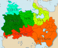 LHA Lhavres States.png 1,324 × 1,108; 92 KB
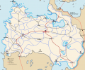 Lhavres Infrastructure.png 1,324 × 1,108; 131 KB
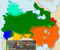 Lhavres Language Map.png 1,324 × 1,108; 99 KB
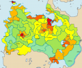 Lhavres Population.png 1,324 × 1,108; 49 KB
 Yaageqye City Map.png 3,200 × 3,200; 853 KB
 Yaakzeksye Location.png 500 × 346; 15 KB
 Čegczaa on map.png 1,440 × 2,103; 237 KB


