File:AlgaziStates.png
Jump to navigation
Jump to search

Size of this preview: 586 × 600 pixels. Other resolution: 1,200 × 1,228 pixels.
Original file (1,200 × 1,228 pixels, file size: 238 KB, MIME type: image/png)
Summary
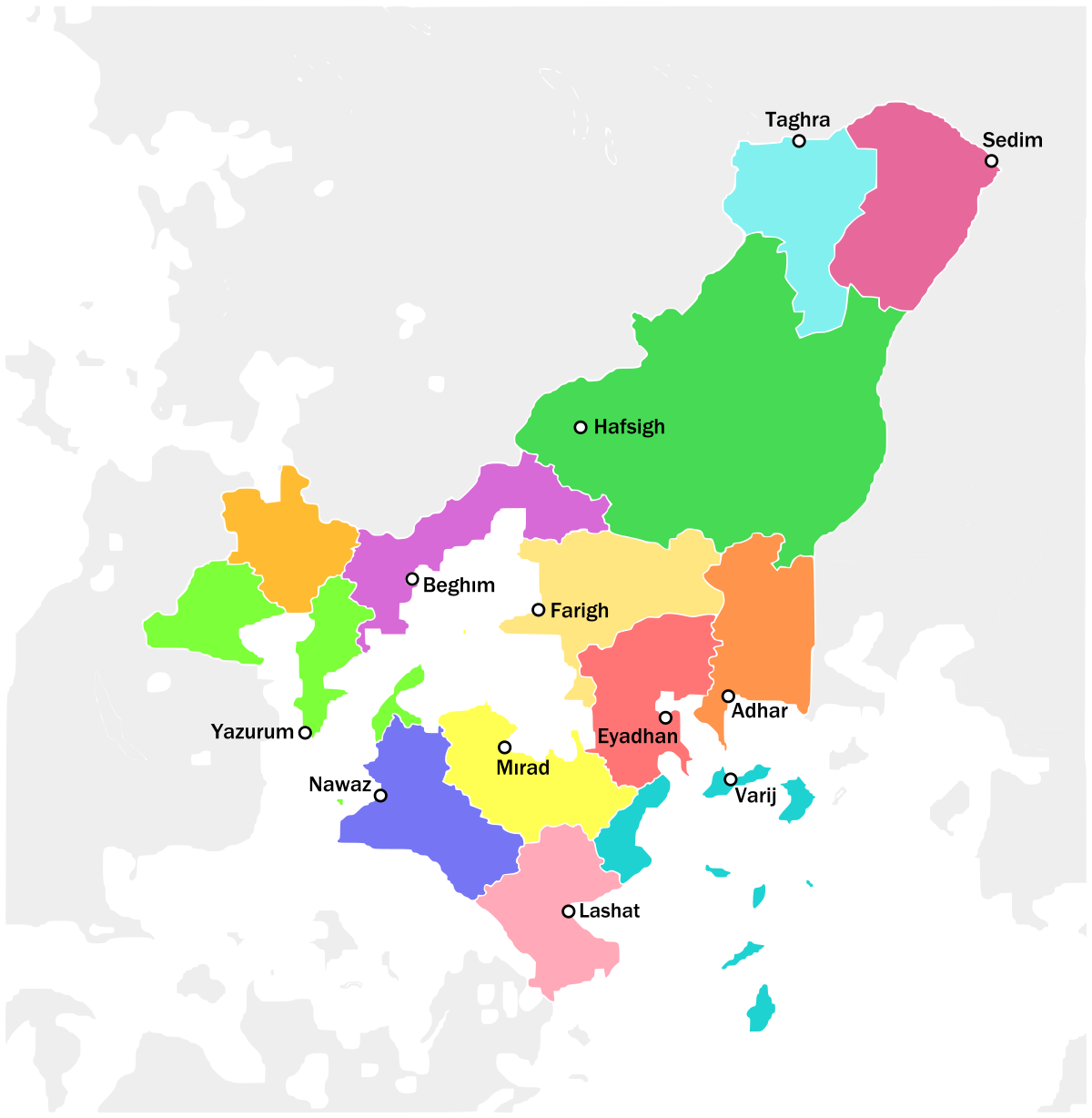
A map of the 13 former city-states that make up the Algazi Union and their territories, as well as the de facto 14th state of Veyski and Daridje (in yellow-orange).
File history
Click on a date/time to view the file as it appeared at that time.
| Date/Time | Thumbnail | Dimensions | User | Comment | |
|---|---|---|---|---|---|
| current | 01:28, 28 August 2023 | | 1,200 × 1,228 (238 KB) | Yrieixgroulx (talk | contribs) | A map of the 13 former city-states that make up the Algazi Union and their territories, as well as the de facto 14th state of Veyski and Daridje (in yellow-orange). |
You cannot overwrite this file.
File usage
There are no pages that use this file.