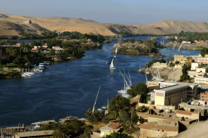
Tabiq River
| Tabiq River | |
|---|---|
 | |
| Basin | |
| Countries | |
The Tabiq River is located entirely within the Ekuosian desert, originating at the Kasingadh lakes in the north and flowing south as a tributary to the Ekuos River. It is of enormous economic and climactic importance to the surrounding arid areas of Tabiqa and Barradiwa, providing transportation and irrigation throughout the year.
Etymology
The most widely-accepted source of the name is Proto-Adzo-Neviric *tawna:q, the specific meaning of which is uncertain, but which became "dust storm" tahmarq in the Adzamic daughter language.
History
The source area of the Tabiq is home to some of the earliest discovered human fossils on Sahar, and some scientists argue that it may represent the homeland of humanity. However, older fossils have been located north of Kasingadh.
It has served as an important natural border between Adzamic and Ekuostian civilizations for millennia, eventually forming the basis for the national borders used today.
In the past 40 years there have been seven instances where the river has run dry in the dry season, an alarming figure in light of the fewer-than-a-dozen such occurrences in previous recorded history. Cooperation between the governments of Tabiqa, Barradiwa and Ebo Nganagam to conserve water and limit wasteful irrigation practices has hopefully prevented further dry-outs.
Course
It begins at the Kasingadh lakes between Tabiqa (to which the river lends its name) and Ebo Ngagama, from which it flows in a south-southwest course to Mehyaran and joins with the larger Ekuos river, delineating most of the border between Tabiqa and Barradiwa along the way. The original source for the Tabiq are the Puzimmese mountains via the Anuxaz river.