Category:Maps of administrative divisions
Jump to navigation
Jump to search
Subcategories
This category has only the following subcategory.
Media in category "Maps of administrative divisions"
The following 49 files are in this category, out of 49 total.
 1st level subdivision in colors of Asesha.png 1,102 × 776; 100 KB
 ACY states map.png 1,267 × 450; 159 KB
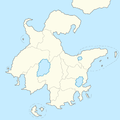
 Administrative Division of Notzel.png 225 × 225; 2 KB
 Atlas-lugida-regions.png 1,820 × 1,860; 341 KB
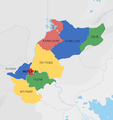
 Balakia states map labelled.png 506 × 544; 34 KB
 Barradiwa Regions.png 1,144 × 1,248; 34 KB
 BRD Barradiwa Internal Map.png 1,144 × 1,248; 176 KB
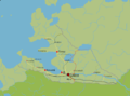
 Dhwer Map.png 3,507 × 2,480; 682 KB
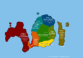
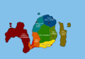
 Ebo states.png 1,142 × 859; 157 KB
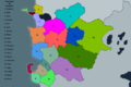
 Gfw map districts labeled colored.png 917 × 858; 137 KB
 Gfw map districts only with less altitude levels.png 917 × 858; 102 KB
 Gushlia regions.png 397 × 325; 4 KB
 Jute map bigger changed regions and counties uncolored, numbered.png 1,512 × 1,060; 151 KB
 Jute map bigger changed regions new names with translation.png 1,512 × 1,060; 193 KB
 Jute map bigger changed regions new names.png 1,512 × 1,060; 154 KB
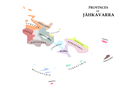 Jáhkavarra-3.png 1,200 × 900; 99 KB
 Karduvic provinces.png 820 × 424; 18 KB
 KhezanProvinces.png 1,192 × 1,076; 50 KB
 Koman Provinces.png 2,250 × 1,687; 512 KB
 LHA Lhavres Internal Map.png 1,324 × 1,108; 54 KB
 LHA Lhavres States.png 1,324 × 1,108; 92 KB
 Liosol Map Of States Labels.svg 0 × 0; 290 KB
 Liosol subdivisions.png 1,088 × 731; 147 KB
 Map of Fazulavaz blank.png 3,821 × 2,702; 459 KB
 Mbamigi Provinces.png 942 × 655; 122 KB
 Mujansaprovinces.png 1,317 × 1,080; 149 KB
 Mwambamep.png 3,001 × 3,000; 1.76 MB
 Nahali political map.png 1,500 × 1,500; 247 KB
 Qonk Map (Geodoot) 2.png 2,267 × 1,696; 392 KB
- Qonk Map svg.svg 0 × 0; 618 KB
 Qonkprovinces.png 2,482 × 1,818; 413 KB
 Riyana map.png 1,624 × 2,952; 976 KB
 RiyanaMap.png 800 × 633; 58 KB
 Sarmaiprovinces.png 1,080 × 1,341; 207 KB
 Seang pe map.png 1,848 × 1,762; 373 KB
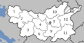
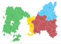
 Siyezanprovinces.png 2,011 × 1,080; 268 KB
 Sngaks.png 1,920 × 1,080; 20 KB
 Sop1850.png 2,510 × 1,252; 83 KB
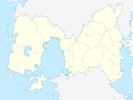
 Soptemia divnames.png 1,200 × 502; 90 KB
 South Jute, based on Curlie's map, administrative divisions, no terrain.png 1,666 × 1,237; 196 KB
 South Jute, based on Curlie's map, administrative divisions.png 1,666 × 1,237; 169 KB
 Tabiqa provinces.png 3,248 × 3,443; 674 KB
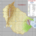
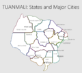 Tuanmali States and Major Cities.png 1,158 × 1,034; 86 KB
 URBCounties.png 3,750 × 2,500; 958 KB
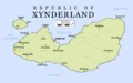 XynderlandMapEnglish.png 1,600 × 1,000; 237 KB
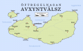 XynderlandMapXynder.png 1,600 × 1,000; 245 KB
 Yazates.png 1,080 × 1,117; 113 KB
 ZaizungRegions.jpg 178 × 150; 11 KB


_2.png)


