File:KhezanProvinces.png
Revision as of 23:01, 12 November 2020 by Astrangemann (talk | contribs) (Astrangemann uploaded a new version of File:KhezanProvinces.png)
Size of this preview: 664 × 599 pixels. Other resolution: 1,192 × 1,076 pixels.
Original file (1,192 × 1,076 pixels, file size: 50 KB, MIME type: image/png)
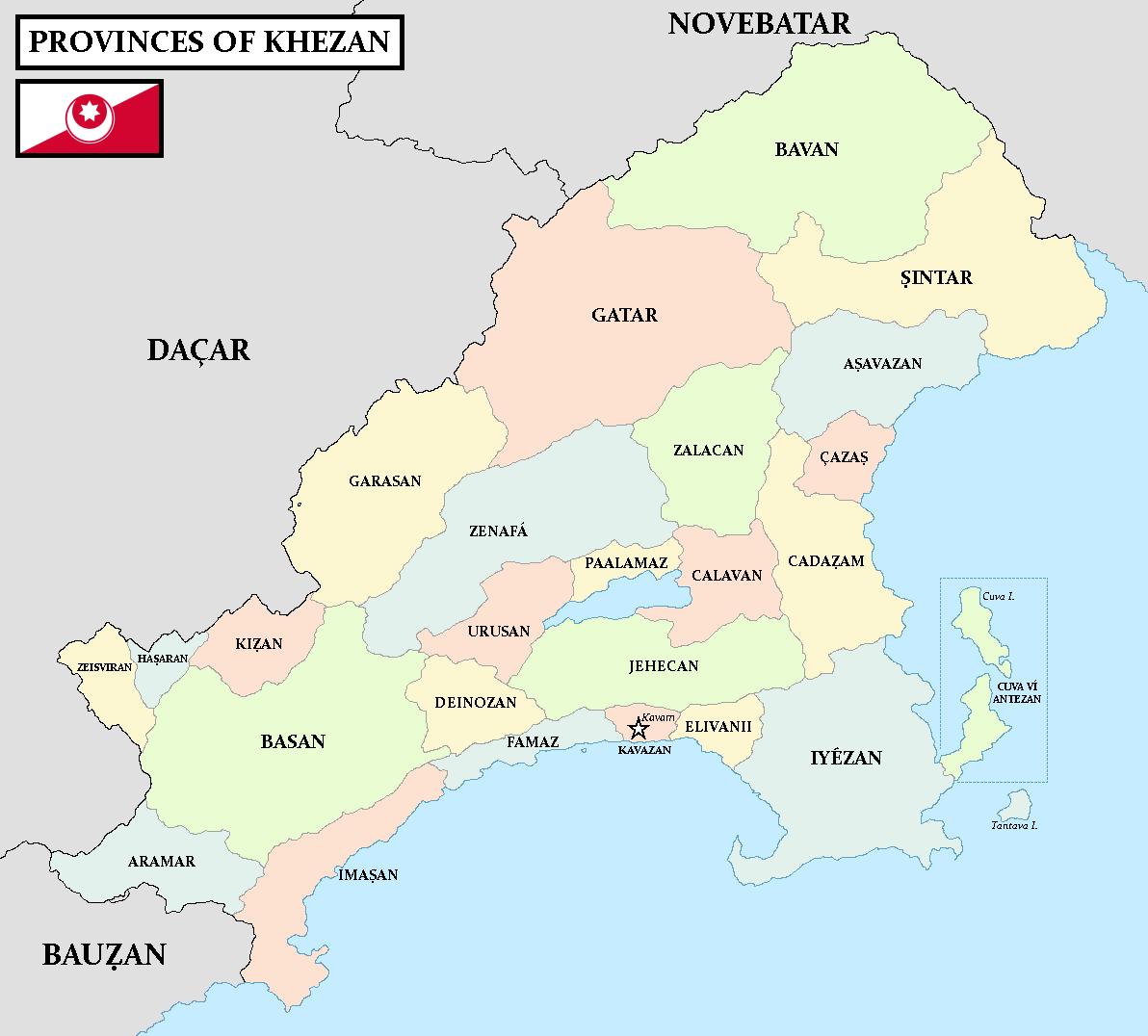
A map of 16 provinces and a number of sub-provinces that I can't be bothered to count, all with their own counties within. There are also cities here, the larger one is typically the capital of that respective province.
File history
Click on a date/time to view the file as it appeared at that time.
| Date/Time | Thumbnail | Dimensions | User | Comment | |
|---|---|---|---|---|---|
| current | 02:35, 27 November 2023 | | 1,192 × 1,076 (50 KB) | Astrangemann (talk | contribs) | |
| 23:01, 12 November 2020 | 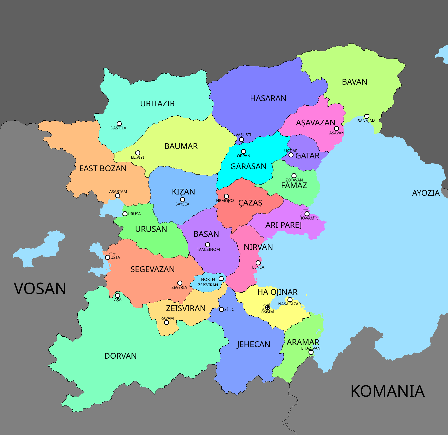 | 1,789 × 1,738 (172 KB) | Astrangemann (talk | contribs) | Now with 22 provinces (and 3 federal cities that kind of are part of their respective province but not really) | |
| 17:33, 15 October 2020 |  | 1,789 × 1,738 (155 KB) | Astrangemann (talk | contribs) | A map of 16 provinces and a number of sub-provinces that I can't be bothered to count, all with their own counties within. There are also cities here, the larger one is typically the capital of that respective province. |
You cannot overwrite this file.
File usage
The following page uses this file: