Difference between revisions of "File:Otofu labeled.png"
Jump to navigation
Jump to search
m |
m |
||
| Line 2: | Line 2: | ||
[[Category:Maps of Boroso]][[Category:Yakormonyo]] | [[Category:Maps of administrative divisions]] [[Category:Maps of Boroso]][[Category:Yakormonyo]] | ||
Revision as of 15:52, 22 June 2021
Map of Otofu City, colour-coded and labeled with towns and quints. Slightly darker colours represent common land.
File history
Click on a date/time to view the file as it appeared at that time.
| Date/Time | Thumbnail | Dimensions | User | Comment | |
|---|---|---|---|---|---|
| current | 12:28, 17 September 2020 | 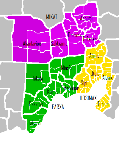 | 400 × 500 (22 KB) | Katrasho (talk | contribs) | Map of Otofu City, colour-coded and labeled with towns and quints. Slightly darker colours represent common land. |
You cannot overwrite this file.
File usage
There are no pages that use this file.