Difference between revisions of "Nögrëyaa"
Jump to navigation
Jump to search
m |
|||
| (7 intermediate revisions by one other user not shown) | |||
| Line 1: | Line 1: | ||
{{Infobox settlement | {{Infobox settlement | ||
| name = | | name = Nögrëyaa | ||
| native_name = | | native_name = | ||
| native_name_lang = <!-- ISO 639-2 code e.g. "fr" for French. If more than one, use {{lang}} instead --> | | native_name_lang = <!-- ISO 639-2 code e.g. "fr" for French. If more than one, use {{lang}} instead --> | ||
| settlement_type = <!-- Leave this line blank! It will give you loose </th></tr> tags at the top of the page --> | | settlement_type = <!-- Leave this line blank! It will give you loose </th></tr> tags at the top of the page --> | ||
| Line 13: | Line 13: | ||
| image_shield = | | image_shield = | ||
| shield_alt = | | shield_alt = | ||
| etymology = | | etymology = On the border of [[Yaa]] | ||
| nickname = | | nickname = The Camp | ||
| motto = | | motto = | ||
| image_map = | | image_map = | ||
| Line 36: | Line 36: | ||
| subdivision_type3 = | | subdivision_type3 = | ||
| subdivision_name3 = | | subdivision_name3 = | ||
| established_title = | | established_title = Founded | ||
| established_date = | | established_date = 1675 CE | ||
| founder = | | founder = | ||
| seat_type = | | seat_type = | ||
| Line 44: | Line 44: | ||
| leader_party = | | leader_party = | ||
| leader_title = Mayor | | leader_title = Mayor | ||
| leader_name = [[ | | leader_name = [[Yïtuunsantëlhaa]] | ||
| unit_pref = Metric | | unit_pref = Metric | ||
<!-- ALL fields with measurements have automatic unit conversion --> | <!-- ALL fields with measurements have automatic unit conversion --> | ||
| Line 96: | Line 96: | ||
| area_code = | | area_code = | ||
| iso_code = | | iso_code = | ||
| website = www. | | website = www.nogreyaa.lh | ||
| footnotes = | | footnotes = | ||
}} | }} | ||
''' | '''Nögrëyaa''' (pronunciation: /ɲʌɣrəjɑ:/) is the capital of [[Lhavres]] and is also its fifth most populated city. | ||
==Etymology== | ==Etymology== | ||
The name literally means "on the border of Yaa". | |||
==History== | ==History== | ||
The city was originally founded on the border between Lhavres and the reaches of the Dhwer Empire to serve as a base of operations for the Lhavrinian military, as the next closest checkpoint was in [[Czarhaa]] and not in a particularly strategic location for terrestrial deployment at the time. Since then, the city has been Lhavres's primary military center. It became the government seat of Lhavres in 1846 not long after the annexation of the [[Setyal Empire]], as the Haanelhotöš felt it was in a central location for governing the nation. | |||
==Geography== | ==Geography== | ||
| Line 128: | Line 132: | ||
[[Category:Settlements]][[Category: | [[Category:Settlements]] [[Category:Capitals]] [[Category:Lhavrinian settlements]] | ||
Latest revision as of 11:25, 18 April 2022
Nögrëyaa | |
|---|---|
 | |
| Etymology: On the border of Yaa | |
| Nickname(s): The Camp | |
| Country | Lhavres |
| Founded | 1675 CE |
| Government | |
| • Mayor | Yïtuunsantëlhaa |
| Area | |
| • City | 1,080 km2 (420 sq mi) |
| • Urban | 190 km2 (70 sq mi) |
| • Metro | 890 km2 (340 sq mi) |
| Population | |
| • City | 10,009,777 |
| • Density | 9,300/km2 (24,000/sq mi) |
| Website | www.nogreyaa.lh |
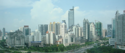
Nögrëyaa (pronunciation: /ɲʌɣrəjɑ:/) is the capital of Lhavres and is also its fifth most populated city.
Etymology
The name literally means "on the border of Yaa".
History
The city was originally founded on the border between Lhavres and the reaches of the Dhwer Empire to serve as a base of operations for the Lhavrinian military, as the next closest checkpoint was in Czarhaa and not in a particularly strategic location for terrestrial deployment at the time. Since then, the city has been Lhavres's primary military center. It became the government seat of Lhavres in 1846 not long after the annexation of the Setyal Empire, as the Haanelhotöš felt it was in a central location for governing the nation.