Difference between revisions of "Archive:Hemesh"
(Created page with "{{Infobox country |conventional_long_name = Hemesh<!--Formal or official full name of the country in English--> |native_name = <!--Country's name (usually full name) in...") |
m (Ava moved page Hemesh to Archive:Hemesh) |
||
| (48 intermediate revisions by 9 users not shown) | |||
| Line 1: | Line 1: | ||
{{ | {{about|the peninsula in Ekuosia|the sovereign state of the same name|Kingdom of Hemesh|other uses|Hemesh (disambiguation)}} | ||
| | {{Infobox peninsulas | ||
| | | name = Hemesh Peninsula | ||
| | | native name = <!-- or |local name= --> | ||
| native name link = | |||
| | | native_name_lang = | ||
| | | sobriquet = <!-- or |nickname= --> | ||
| | | image name = Flag of hemesh?.png | ||
| | | image size = 150px | ||
| | | image caption = Unofficial flag | ||
| | | image alt = The pan-Hemeshi flag used by pan-Hemeshi nationalists | ||
| map = Locator_map_Hemesh_(peninsula).png | |||
| | | map_alt = | ||
| | | map_width = 200px | ||
| map_caption = Location of the peninsula (green) | |||
| | | map_relief = | ||
| | | label = | ||
| | | label_position = | ||
| lat_d = | |||
| lat_m = | |||
| | | lat_s = | ||
| lat_NS = | |||
| | | long_d = | ||
| | | long_m = | ||
| | | long_s = | ||
| | | long_EW = | ||
| | | x = | ||
| | | y = | ||
| | | x% = | ||
| | | y% = | ||
| | | etymology = | ||
| | | location = [[Argeyaz Bay]], [[Gulf of Ishenar]] | ||
| | | type = | ||
| | | pop = | ||
| | | region = [[Ekuosia]] | ||
| | | dim = | ||
| | | scale = | ||
| | | source = | ||
| | | display = | ||
| | | format = | ||
| | | archipelago = | ||
| | | waterbody = | ||
| total islands = | |||
| | | major islands = Ksham Island | ||
| area km2 = 1020890 | |||
| | | area footnotes = | ||
| | | rank = | ||
| | | length km = <!-- or |length m= --> | ||
| | | length footnotes = | ||
| | | width km = <!-- or |width m= --> | ||
| | | width footnotes = | ||
| | | coastline km = <!-- or |coastline m= --> | ||
| | | coastline footnotes = | ||
| | | elevation m = | ||
| | | elevation footnotes = | ||
| highest mount = | |||
| Country heading = Countries | |||
| | |||
| | | country = {{flag|Fyevan}} | ||
| | | country capital = [[Kuvsvjad]] | ||
| | | country area km2 = 191923 | ||
| | | country 2 = {{flag|Hemesh}} | ||
| | | country 2 capital = [[Gemet]] | ||
| | | country 2 area km2 = 242983 | ||
| | | country 3 = {{flag|Orzun}} | ||
| | | country 3 capital = ??? | ||
| | | country 3 area km2 = 206379 | ||
| | | country 5 = {{flag|Sroyos}} | ||
| | | country 5 capital = ??? | ||
| | | country 5 area km2 = 379605 | ||
| | | demonym = Hemeshi | ||
| | | population = 87,500,000 | ||
| | | population as of = 2015 | ||
| population footnotes = | |||
| | | population rank = | ||
| | | population rank max = | ||
| | | density km2 = 85.71 | ||
| | | density rank = | ||
| | | density footnotes = | ||
| | | ethnic groups = | ||
| | | timezone1 = <!-- [[Sahar Coordinated Time|SCT]]-1 to SCT+0 --> | ||
| | | utc_offset1 = | ||
| | | timezone2 = | ||
| | | utc_offset2 = | ||
| | | website = | ||
| | | additional info = | ||
| | |||
| | |||
| | |||
| | |||
| | |||
| | |||
| | |||
| | |||
| | |||
| | |||
| | |||
| | |||
| | |||
| | |||
| | |||
| | |||
| | |||
| | |||
| | |||
| | |||
}} | }} | ||
'''Hemesh''' | The '''Hemesh Peninsula''', or simply '''Hemesh''', is a large peninsula located in the southwestern portion of [[Ekuosia]]. Initially the home of coast-dwelling fishing cultures, the peninsula was settled permanently by Argeyazic tribes as early as 400 BCE, primarily along the coast. The area was a hotbed of regional variation for more than 2,000 years. | ||
==Etymology== | ==Etymology== | ||
==History== | ==History== | ||
The peninsula was united by the [[Terminian Empire]] in 1322 CE, which gave way to the peninsula becoming its own empire after Terminia's decline in the mid-1400s. <!--- This is not canonical / A rocky history with Nevira developed during the era of the [[Kauzic Empire]], in which part of the peninsula was conquered by [[General Sao]] in 1484, and amidst the chaos Emperor Sayasho was killed in battle. Without his uniting force, the rest of the peninsula plunged into civil war that spanned decades. In 1506, Sayasho's grandson [[Adoz I|Adoz]] reunited the warring states, then attempted to exact revenge on Nevira; a grave mistake. | |||
Nevira bit back by having Sao's territory assimilated to Kauzic culture, which inadvertently led to the gradual collapse of the Nevira Empire as its vassal realms either defected or fell to rebels due to being weakened. After Nevira's collapse in 1524, the territory of Saovia nominally served the ruler in [[Yisma]].---> Hemesh's attempts to reintegrate Saovia were mostly ineffective, not helped by the scheming [[Algazi League]] beginning to gain power in the region. Eventually Saovia was reincorporated, but not without flaw. | |||
Since then the peninsula remained politically stable only through relentless compromise with the factions that made up most of the ruling elite, and as a result the [[Hemesh Empire]] was never a particularly strong force. During the 17th Century [[Norjihan]] managed to use the weakness of the Empire to carve out a protectorate in modern [[Sroyos]]. During the 18th century, areas of western Hemesh were conquered by [[Terminian Three Kingdoms|Terminia]] (who used their rule over Hemesh in the 13-1400s as justification) and [[Kingdom of Letzia|Letzia]]. | |||
During the [[Great Ekuosian War]], Hemesh's monarchy was overthrown by Letzian-sponsored insurgent Korsa Olboros, which supported the Unity side of the war. However, his authority quickly crumbled and in 1950 the divided peninsula was occupied by the new Allied Letzian regime, the [[Algazi Union]], and Kúúlist militias. During the peace negotiations, the peninsula was divided into [[Hemesh (country)|West Hemesh]] (including areas which had remained Letzian until the GEW), [[East Hemesh]] and the Helsonian satellite state of [[Orzun]]. | |||
However, this failed to stabilise the region. In 1962, faced with a linguistically similar but culturally divided population, East Hemesh collapsed into 3 independent polities. Only three years later, the formerly Terminian and predominantly Pashaist region of West Hemesh unilaterally declared independence as [[Fyevan]]. | |||
== | ==Demographics== | ||
==Economy== | ==Economy== | ||
[[Category:Peninsulas]][[Category:Geography of Ekuosia]][[Category:Hemesh]] | |||
Latest revision as of 22:40, 12 January 2024
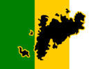
 Unofficial flag | |
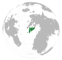
| Location of the peninsula (green) | |
| Geography | |
|---|---|
| Location | Argeyaz Bay, Gulf of Ishenar |
| Major islands | Ksham Island |
| Area | 1,020,890 km2 (394,170 sq mi) |
| Countries | |
| Capital city | Kuvsvjad |
| Area covered | 191,923 km2 (74,102 sq mi; 18.8%) |
| Capital city | Gemet |
| Area covered | 242,983 km2 (93,816 sq mi; 23.8%) |
| Capital city | ??? |
| Area covered | 206,379 km2 (79,683 sq mi; 20.2%) |
| Capital city | ??? |
| Area covered | 379,605 km2 (146,566 sq mi; 37.2%) |
| Demographics | |
| Demonym | Hemeshi |
| Population | 87,500,000 (as of 2015) |
| Density | 85.71 /km2 (221.99 /sq mi) |
The Hemesh Peninsula, or simply Hemesh, is a large peninsula located in the southwestern portion of Ekuosia. Initially the home of coast-dwelling fishing cultures, the peninsula was settled permanently by Argeyazic tribes as early as 400 BCE, primarily along the coast. The area was a hotbed of regional variation for more than 2,000 years.
Etymology
History
The peninsula was united by the Terminian Empire in 1322 CE, which gave way to the peninsula becoming its own empire after Terminia's decline in the mid-1400s. Hemesh's attempts to reintegrate Saovia were mostly ineffective, not helped by the scheming Algazi League beginning to gain power in the region. Eventually Saovia was reincorporated, but not without flaw.
Since then the peninsula remained politically stable only through relentless compromise with the factions that made up most of the ruling elite, and as a result the Hemesh Empire was never a particularly strong force. During the 17th Century Norjihan managed to use the weakness of the Empire to carve out a protectorate in modern Sroyos. During the 18th century, areas of western Hemesh were conquered by Terminia (who used their rule over Hemesh in the 13-1400s as justification) and Letzia.
During the Great Ekuosian War, Hemesh's monarchy was overthrown by Letzian-sponsored insurgent Korsa Olboros, which supported the Unity side of the war. However, his authority quickly crumbled and in 1950 the divided peninsula was occupied by the new Allied Letzian regime, the Algazi Union, and Kúúlist militias. During the peace negotiations, the peninsula was divided into West Hemesh (including areas which had remained Letzian until the GEW), East Hemesh and the Helsonian satellite state of Orzun.
However, this failed to stabilise the region. In 1962, faced with a linguistically similar but culturally divided population, East Hemesh collapsed into 3 independent polities. Only three years later, the formerly Terminian and predominantly Pashaist region of West Hemesh unilaterally declared independence as Fyevan.
