Difference between revisions of "Gelog Sea"
| Line 85: | Line 85: | ||
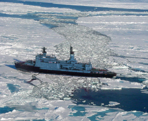
[[File:Homjqeang.jpg|thumbnail|left|A Qgamic nuclear-powered icebreaker operating in the Gelög sea.]]Long-term measurements made within the top 2 metres at the port of [[Caa Ļer]] show a maximum average summer surface temperature ranging from approximately 6°C to 10°C, and a minimum winter temperature of -1°C. | [[File:Homjqeang.jpg|thumbnail|left|A Qgamic nuclear-powered icebreaker operating in the Gelög sea.]]Long-term measurements made within the top 2 metres at the port of [[Caa Ļer]] show a maximum average summer surface temperature ranging from approximately 6°C to 10°C, and a minimum winter temperature of -1°C. | ||
As precipitation generally outweighs evaporation, the average salinity is quite low, varying between 9‰ and 16‰. Consequently, the sea is generally at least partially frozen during an average of | As precipitation generally outweighs evaporation, the average salinity is quite low, varying between 9‰ and 16‰. Consequently, the sea is generally at least partially frozen during an average of five months of the year. | ||
==Ecosystem== | ==Ecosystem== | ||
Revision as of 04:16, 25 August 2017
| Gelög Sea | |
|---|---|
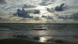
 Gelög Sea coast | |
| Type | Sea |
| Basin countries | Coastal Aquihia Cathilea Ceothia |
| Salinity | 0.65% |
| Frozen | Freezes over in winter |
| Islands | 29 |
| Settlements | Caa Ļer Cathindiaegh |
The Gelög Sea is a large marginal sea in the west of Miraria. It is enclosed by the peninsulas of Western Miraria and Soltenna, and is linked to the Sea of Alpa at its western extent. The sea is notable for its low salinity, which results in it completely freezing over yearly.
Etymology
The Gelög Sea was named by aliens. They didn't name anything else.
History
Geography
The Gelög Sea is a semi-enclosed sea, and its extents are defined as follows:
- On the North: by the eastern extent of the eastern island of Jolia SAR and the western extent of the Rehleysa Peninsula in Ngeyvger, following the southern coast of Ngeyvger et al.
- On the East: by the western extent of the Bay of Uoku in Ensia and Suenia.
- On the South: by the northern coast of Liosol et al.
- On the West: by the extent of the southeastern peninsula of the eastern island of Jolia SAR extending down to the southern Jolian islands and ultimately to the Šde Peninsula in Qgam.
Major rivers that empty into the Gelög Sea include three rivers in Ngeyvger, one river in Cathilea, and one river in Ensia and Suenia.
Hydrology and Climate
Long-term measurements made within the top 2 metres at the port of Caa Ļer show a maximum average summer surface temperature ranging from approximately 6°C to 10°C, and a minimum winter temperature of -1°C.
As precipitation generally outweighs evaporation, the average salinity is quite low, varying between 9‰ and 16‰. Consequently, the sea is generally at least partially frozen during an average of five months of the year.
