Difference between revisions of "Category:Out of date"
Jump to navigation
Jump to search
(previous page) (next page)
(Created blank page) |
Alynnidalar (talk | contribs) |
||
| Line 1: | Line 1: | ||
[[Category:Maintenance]] | |||
Revision as of 01:56, 5 September 2017
Pages in category "Out of date"
The following 33 pages are in this category, out of 229 total.
(previous page) (next page)V
Ó
Media in category "Out of date"
The following 200 files are in this category, out of 210 total.
(previous page) (next page) 1400 CE Boroso Nagu.png 1,100 × 1,670; 146 KB
 1982 ISR world cup.png 892 × 473; 41 KB
 Aciq.png 764 × 423; 19 KB
 Administration Division of Ebo Nganagam.png 480 × 360; 8 KB
 Aireimam.png 707 × 329; 33 KB
 AKN.png 1,200 × 800; 37 KB
 AKN2.png 1,300 × 866; 18 KB
 AKN4.png 1,300 × 866; 16 KB
 AKNcounty.png 899 × 1,080; 19 KB
 AKNewsLogo.png 1,092 × 198; 27 KB
 AlcianCommission.png 900 × 1,200; 68 KB
 AlcianCommission.svg 512 × 683; 10 KB
 Amaism-Symbol.png 211 × 211; 3 KB
 Ammaria locator.png 800 × 369; 50 KB
 Antarri Consonants.png 671 × 248; 15 KB
 Antarri Vowels.png 283 × 218; 6 KB
 Anteczasta.svg 512 × 512; 1 KB
 Antiden Religious Chart.png 393 × 326; 9 KB
 Antiden Star.png 602 × 574; 6 KB
 Antiden White Army Emblem.png 346 × 355; 3 KB
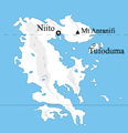
 Anuxaz map.png 489 × 401; 17 KB
 Arnahoatema.png 2,732 × 2,048; 338 KB
 Arrym Map.png 958 × 1,350; 57 KB
 Ashar script1.png 427 × 27; 2 KB
 Ashar-inscription.png 200 × 41; 3 KB
 Ashar-scrip1.png 427 × 27; 3 KB
 AUFlag.png 1,250 × 833; 37 KB
 Bankofszezkia.svg 512 × 778; 95 KB
 Caese1.jpg 232 × 300; 26 KB
 Calutian empire map.png 1,078 × 569; 9 KB
 Cape Dip and the Great Dip peninsula.png 40 × 40; 383 bytes
 Claim.PNG 238 × 246; 9 KB
 Coat of Arms.png 962 × 1,228; 626 KB
 Coheliamap.png 1,026 × 402; 70 KB
 ConcordiaResidential.png 1,200 × 644; 965 KB
 Continents.png 4,584 × 2,292; 1.06 MB
 Counterfeiting Flutufirp.jpeg 1,311 × 701; 83 KB
 Czisilia script2.png 648 × 136; 6 KB
 Danshapu Location.png 587 × 406; 88 KB
 DaquenScript.png 379 × 114; 3 KB
 Darudi flag - Copy (2) - Copy.png 250 × 150; 63 KB
 Dehimaksi.png 300 × 200; 3 KB
 Dhena-physical-map.png 846 × 976; 276 KB
 Drawing (4).jpeg 171 × 116; 8 KB
 Dulozi railway.png 268 × 255; 5 KB
 DulozudPoliticalBase.png 537 × 587; 62 KB
 Dzalúnaucalap.jpg 1,024 × 714; 827 KB
 Ebo Aga Empire 1550.jpg 400 × 360; 21 KB
 Edideras.png 300 × 200; 1 KB
 Eliposi locator.png 2,161 × 2,157; 613 KB
 Elrojho Map pre mettat greatest extent.jpg 1,028 × 603; 59 KB
 Eng Nax Islands satellite.png 142 × 119; 20 KB
 Eng Nax Islands.png 100 × 100; 1 KB
 Eresa script2.png 449 × 181; 5 KB
 Faljüdax.PNG 633 × 147; 7 KB
 FlagOfRedia.png 1,200 × 600; 5 KB
 GabScript.png 148 × 65; 1 KB
 General map PUL.png 123 × 148; 2 KB
 GfiewistanFlag.png 1,084 × 644; 12 KB
 Globeonterin.png 1,920 × 974; 231 KB
 GreaterAvdjeregLocator.svg 161 × 137; 68 KB
 Haisearydistricts.png 3,696 × 1,860; 265 KB
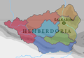 HemberdoriaMap.png 240 × 166; 8 KB
 Hmaephla Klet written.png 1,080 × 1,397; 25 KB
 HXEArt1.jpg 640 × 270; 169 KB
 HXEFlag.png 1,071 × 712; 40 KB
 Icoa20.png 2,980 × 1,600; 5.94 MB
 ImperialStructure.png 1,006 × 641; 81 KB
 ISR logo.png 713 × 354; 5 KB
 Istanmap.png 1,857 × 598; 88 KB
 Ittohar-baredina.png 480 × 431; 39 KB
 Ittoharprovinces.png 3,376 × 3,480; 76 KB
 Jute locator globe.png 717 × 717; 88 KB
 KaisenSea.png 149 × 91; 22 KB
 Kauzic empire.png 1,250 × 650; 50 KB
 Kawa mountains location.png 160 × 160; 9 KB
 Kawa mountains satellite.png 160 × 160; 58 KB
 Kawa mountains.png 160 × 160; 8 KB
 KSAnthem.ogg ; 1.64 MB
 KSGlocator.png 1,130 × 1,128; 188 KB
 KSLocatorMap.svg 512 × 420; 15.67 MB
 KSStates.svg 512 × 512; 14 KB
 KuriTreatySign.png 414 × 585; 33 KB
 Lake way-map.png 348 × 289; 6 KB
 LakeVaniu¿.png 94 × 107; 21 KB
 LakeYerlan.png 49 × 76; 21 KB
 Letsic Language Range.png 948 × 753; 138 KB
 Letziaworldcup2016.png 883 × 1,006; 60 KB
 Levcountry2.png 760 × 470; 17 KB
 LhivCOA.png 962 × 1,228; 626 KB
 Lhivflag.png 1,337 × 897; 70 KB
 Location of Aleksej.png 2,000 × 1,200; 58 KB
 Location of Antoerishka.png 2,000 × 1,200; 58 KB
 Location of Baronisht.png 2,000 × 1,200; 57 KB
 Location of Bvarodoi.png 2,000 × 1,200; 58 KB
 Location of Galsiya.png 2,000 × 1,200; 58 KB
 Location of Nganagam Kep.png 50 × 50; 541 bytes
 Locator globe Aayke Ngol.png 600 × 588; 56 KB
 Locator globe Methinaqh.png 600 × 588; 58 KB
 Locator globe Pakunel.png 600 × 588; 60 KB
 Locator globe Tsagon.png 600 × 588; 51 KB
 Locator globe Waytseia.png 600 × 588; 79 KB
 Loknai Canton Flag.png 700 × 700; 10 KB
 Lower Ekuosia.png 905 × 596; 92 KB
 Lórz Flag3.png 907 × 624; 23 KB
 Macrovajusanmap.png 319 × 274; 22 KB
 Mag.PNG 497 × 455; 39 KB
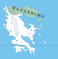 Magarnimo.PNG 238 × 243; 9 KB
 Mahavia on a map.png 2,722 × 1,366; 541 KB
 Majeseruidi flag small.png 100 × 66; 7 KB
 Maknahq.png 750 × 438; 664 KB
 MaksejRoyalCypher.svg 512 × 341; 99 KB
 Mandriliamap01.PNG 2,732 × 2,048; 1.4 MB
 Mastatet.png 1,822 × 821; 40 KB
 Meritocratic Republic of Myak Kham ca. 1600 AD.png 500 × 500; 15 KB
 MezkanParliament.png 416 × 362; 90 KB
 Motivi wiki.png 638 × 590; 107 KB
 Mowat Qāza-sē Qālqāra.png 550 × 60; 2 KB
 MZK small.png 100 × 106; 9 KB
 MZK-eb08ed1991fbd636ade5dd7e8595e092516bfcd9.png 100 × 66; 2 KB
 Nations of Ekuosia.png 1,170 × 782; 397 KB
 NFE.png 2,100 × 1,260; 273 KB
 Nixa Kapunahi.jpg 640 × 480; 54 KB
 NomuzCentral.png 797 × 500; 164 KB
 Norjilocator.png 455 × 453; 41 KB
 Norn-Allorin.jpg 460 × 276; 14 KB
 NorthenUnionMap.png 1,618 × 888; 133 KB
 Nousregiones.png 331 × 486; 27 KB
- Nousuerian islands.pngNousuerian islands.png File missing
 Onterin states.png 392 × 384; 10 KB
 Palavozlo Kingdom maximum.png 200 × 150; 2 KB
 Political Map of Nmasinha.png 113 × 113; 1 KB
 Political Map of PEH.png 899 × 1,080; 11 KB
 Q'eb empire ca. 200 BC to ca. 1200 AD.png 400 × 400; 14 KB
 Q'eb Empire from 1481 AD to 1501 AD.png 400 × 400; 13 KB
 Q'eb Empire from 1501 AD to 1832 AD - Q'eb Proper.png 400 × 400; 14 KB
 Q'eb Empire from about 1200 AD to 1481 AD.png 400 × 400; 14 KB
 QONKSZ.png 658 × 394; 72 KB
 QONKSZEMBLEM.png 1,626 × 1,626; 599 KB
 Quatingeing Location1.png 2,553 × 1,276; 1,010 KB
 QuatiScript.png 312 × 84; 3 KB
 QuedrelUnionLogo.png 365 × 356; 25 KB
 Qālqārşē.png 805 × 189; 5 KB
 Ragya.png 597 × 550; 46 KB
 Regions52.JPG 1,366 × 1,024; 116 KB
- Error creating thumbnail: File with dimensions greater than 12.5 MPRoad Map of Sahar.png 7,000 × 4,103; 1.14 MB
 Rotnoj-Kezsnem.svg 512 × 512; 1 KB
- Error creating thumbnail: File with dimensions greater than 12.5 MPSahar blank map.png 11,103 × 5,549; 1.48 MB
 Sahar map IKV.png 536 × 480; 75 KB
 Sahar map2.png 889 × 889; 172 KB
 Sahar-EQ2.png 4,085 × 2,043; 2.83 MB
 Screen Shot 2017-08-24 at 10.37.31 PM.png 658 × 394; 72 KB
 Screen Shot 2018-03-27 at 10.06.53.png 587 × 406; 88 KB
 Seal.png 711 × 603; 49 KB
 Seczki-LanhstruzichHoldings.svg 512 × 512; 4 KB
 SeithinScript.png 1,057 × 118; 7 KB
 SeithinScript2.png 320 × 106; 3 KB
 Selgvodflag.png 1,157 × 771; 22 KB
 Seremetflag.png 1,000 × 500; 34 KB
 Seremetlocale.png 138 × 146; 6 KB
 Setoel flag.png 784 × 504; 3 KB
 SettianFlag.svg 1,500 × 1,000; 4 KB
 Shizam Test.png 400 × 25; 3 KB
 Siabeflag.png 2,014 × 1,684; 83 KB
 Signature nierva.jpg 1,724 × 683; 107 KB
 Solama flag.png 960 × 600; 7 KB
 Sotanxina Flag.png 900 × 600; 25 KB
 Suvekiflag.svg 744 × 1,052; 62 KB
 Suvekiflagbetter.svg 1,288 × 859; 3 KB
 SWSzezkXhovianSettlement.jpg 800 × 600; 69 KB
 Syltael flag.png 1,352 × 900; 41 KB
 Thagha Test.png 353 × 287; 16 KB
 The Five Ebo Aga Kingdoms.jpg 400 × 360; 27 KB
- Error creating thumbnail: File with dimensions greater than 12.5 MPTimezones.png 5,094 × 2,547; 828 KB
 Tisnoij Government Insignia.png 271 × 264; 3 KB
 Tnaaq.png 257 × 466; 32 KB
 Trans-Ekuosian Railway route map.png 1,158 × 774; 365 KB
 True Left flag.png 2,704 × 1,706; 22 KB
 Ulvam high-rez.png 3,050 × 2,050; 101 KB
 Ulvam Provincial Map.png 1,550 × 989; 43 KB
 Ulvam seal but glowy.png 256 × 256; 22 KB
 Ulvash Provinces Map New.png 1,550 × 989; 43 KB
 United sahar regions 8.png 997 × 498; 178 KB
 Updated shekku.PNG 449 × 447; 35 KB
 Uvanga locator.png 2,161 × 2,157; 592 KB
 Vaamek locator.png 1,016 × 994; 92 KB
 Vaniu bagel map.png 760 × 550; 75 KB
 Vaniu bagel smol.png 400 × 290; 45 KB
 Vemou locator.png 2,161 × 2,157; 663 KB
 Viunze.png 884 × 985; 53 KB
 VUT05back.png 1,322 × 1,322; 181 KB
 WaitseiaScript.png 633 × 108; 5 KB
 WAR logo.png 407 × 399; 9 KB
 Wikilogo.png 744 × 963; 238 KB
 Woop.png 512 × 512; 200 KB
 WYZ-Alphabet.png 1,200 × 818; 34 KB
 WäytseiaScript.png 449 × 109; 4 KB
 WäytseiaScript2.png 650 × 113; 5 KB
 WäytseiaScript3.png 1,371 × 117; 9 KB
 X-16.png 1,300 × 585; 732 KB


_-_Copy.png)


.jpeg)


