Difference between revisions of "List of sovereign states and dependent territories in Alpa"
Jump to navigation
Jump to search
m (Updating Oswanukrama to correct name) |
|||
| (48 intermediate revisions by 13 users not shown) | |||
| Line 1: | Line 1: | ||
{{OOD}} | |||
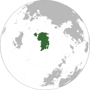
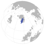
[[File:Alpa Locator.png|thumb|right|300px|Location of Alpa on Sahar]] | |||
The list below details all fully and partially recognized states and territories in [[Alpa]]. | |||
==Countries and dependencies== | ==Countries and dependencies== | ||
Alpa is divided into | Alpa is divided into five sovereign nations and one overseas dependency. | ||
===Recognized states=== | ===Recognized states=== | ||
<!--Don't fill in the Map column yet please--> | <!--Don't fill in the Map column yet please--> | ||
{| class="wikitable sortable" style="width: | {| class="wikitable sortable" style="width:70% " | ||
! class="unsortable" style="font-weight: bold;" | Flag | ! class="unsortable" style="font-weight: bold;" | Flag | ||
! class="unsortable" style="font-weight: bold;" | Map | ! class="unsortable" style="font-weight: bold;" | Map | ||
| Line 20: | Line 20: | ||
! style="font-weight: bold;" | Notes | ! style="font-weight: bold;" | Notes | ||
|- | |- | ||
| [[File: | | [[File:Flag of Nordjaelm.png|100px|frameless|center]] | ||
| <!-- map --> | | <!-- map --> [[File:NDJ Locator Map.png|150px|frameless|center]] | ||
| [[ | | [[Nordjaelm]] | ||
| [[ | | [[Legim language|Legim]]: Nordjælm | ||
| [[ | | [[Kjonnia]] | ||
| | | 18,280,000 | ||
| | | | ||
| <!-- notes --> | | <!-- notes --> | ||
|- | |- | ||
| [[File: | | [[File:Oshanirama Flag.png|100px|frameless|center]] | ||
| <!-- map --> | | <!-- map --> [[File:Oshanirama Locator Map.png|150px|frameless|center]] | ||
| [[Oswanukrama]]<br><small>Republic of Oswanukrama</small> | |||
| [[Oswanukramese]]: oθwɑnukrɑmɑ | |||
| [[Andvas]] | |||
| 2,772,408 | |||
| {{convert|115,517|km2|sqmi}} | |||
| [[ | |||
| [[ | |||
| [[ | |||
| | |||
| {{convert| | |||
| <!-- notes --> | | <!-- notes --> | ||
|- | |- | ||
| [[File:Sanmra flag.png|100px|frameless|center]] | | [[File:Sanmra flag.png|100px|frameless|center]] | ||
| <!-- map --> | | <!-- map --> [[File:SAN Locator Map.png|150px|frameless|center]] | ||
| [[Sanmra]]<br> | | [[Sanmra]]<br><small>Nation of Sanmra</small> | ||
| [[Tirina]]: Sanmra<br>Adıfas ni Sanmra | | [[Tirina]]: Sanmra<br><small>Adıfas ni Sanmra</small> | ||
| [[Elten]] | | [[Elten]] | ||
| 5,165,423 | | 5,165,423 | ||
| {{convert|305,827|km2|sqmi}} | | {{convert|305,827|km2|sqmi}} | ||
| <!-- notes --> | |||
|- | |||
| [[File:SouthAlpaFlag.png|100px|frameless|center]] | |||
| <!-- map -->[[File:Sudhoshos Locator.png|150px|frameless|center]] | |||
| [[South Alpa]]<br><small>Second Republic of South Alpa</small> | |||
| | |||
| [[Kyshku]], [[Diegan]] | |||
| 12,620,000 | |||
| {{convert|748,140|km2|sqmi}} | |||
| <!-- notes --> | | <!-- notes --> | ||
|- | |- | ||
|} | |} | ||
== | ===Dependencies=== | ||
[[Category: | |||
[[Category:Alpa]][[Category:Countries in Alpa|*]][[Category:Continents]][[Category:Lists of countries]] | |||
Latest revision as of 16:26, 1 October 2023
 | This article or section is out of date. A country/countries relevant to this article have been removed from Sahar and have been retconned. Not everything here may still be considered canonical. This article was last edited by P0lyMATH (talk | contribs) 6 months ago. (Update) |
The list below details all fully and partially recognized states and territories in Alpa.
Countries and dependencies
Alpa is divided into five sovereign nations and one overseas dependency.
Recognized states
| Flag | Map | Short and formal names | Domestic short and formal names | Capital | Population | Area | Notes |
|---|---|---|---|---|---|---|---|
| Nordjaelm | Legim: Nordjælm | Kjonnia | 18,280,000 | ||||
| Oswanukrama Republic of Oswanukrama |
Oswanukramese: oθwɑnukrɑmɑ | Andvas | 2,772,408 | 115,517 square kilometres (44,601 sq mi) | |||
| Sanmra Nation of Sanmra |
Tirina: Sanmra Adıfas ni Sanmra |
Elten | 5,165,423 | 305,827 square kilometres (118,080 sq mi) | |||
| South Alpa Second Republic of South Alpa |
Kyshku, Diegan | 12,620,000 | 748,140 square kilometres (288,860 sq mi) |
