Difference between revisions of "List of sovereign states"
Jump to navigation
Jump to search
m (Arnoldii moved page List of countries to List of sovereign states: eh) |
(re-tabling in progress) |
||
| Line 1: | Line 1: | ||
:''"List of countries" redirects here. For other country lists, see [[Lists of countries]].'' | |||
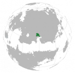
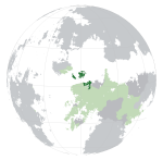
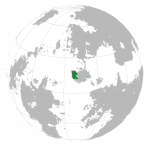
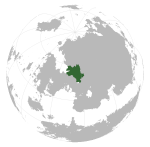
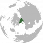
[[File:IC Locator.png|thumb|right|350px|{{legend|#336733|Founding Members}}]] | [[File:IC Locator.png|thumb|right|350px|{{legend|#336733|Founding Members}}]] | ||
This '''list of sovereign states''' provides an overview of fully and partially recognized sovereign states, including its membership status in the [[International Congress]]. There are currently [number] sovereign states. | |||
== | ==List of states== | ||
<!-- | |||
table to be used please don't delete | |||
Regions: | |||
- Asuranesia - Nagu | |||
- Alpa - Parshita | |||
- Atsiq - Puzimm | |||
=== | - South Baredina - Soltenna | ||
- Lower Boroso - Vaniua | |||
- Upper Boroso - Ystel | |||
- Ekuosia | |||
- Lahan | |||
- North Miraria | |||
- Northwest Miraria | |||
--> | |||
{| class="wikitable sortable" style="width:100%" | |||
! colspan="2" | Common name | |||
! Formal name | |||
! Region | |||
! [[International Congress|IC]] Membership | |||
! Sovereignty/territorial disputes | |||
! Notes | |||
|- | |||
| [[File:Acy_flag.png|40px|frameless|center]] | |||
| '''[[Achiyitqana]]'''<br>{{small|Allied Territories of the Achiyitqan Peoples}} | |||
| ''Aciyitqána'' {{small|([[Achiyitqan language|Achiyitqan]])}}<br>{{small|Cakoonukulbaat Aciyitqánakeya}} | |||
| [[North Miraria]] | |||
| IC member state | |||
| None | |||
| | |||
|- | |||
|} | |||
{| class="wikitable sortable" style="width:100%" | {| class="wikitable sortable" style="width:100%" | ||
! class="unsortable" style="font-weight: bold;" | Flag | ! class="unsortable" style="font-weight: bold;" | Flag | ||
| Line 341: | Line 337: | ||
|} | |} | ||
[[Category: | ==See also== | ||
[[Category:International Congress]] | |||
Revision as of 00:58, 26 March 2018
- "List of countries" redirects here. For other country lists, see Lists of countries.
File:IC Locator.png
Founding Members
This list of sovereign states provides an overview of fully and partially recognized sovereign states, including its membership status in the International Congress. There are currently [number] sovereign states.
List of states
| Common name | Formal name | Region | IC Membership | Sovereignty/territorial disputes | Notes | |
|---|---|---|---|---|---|---|
| Achiyitqana Allied Territories of the Achiyitqan Peoples |
Aciyitqána (Achiyitqan) Cakoonukulbaat Aciyitqánakeya |
North Miraria | IC member state | None | ||
| Flag | Map | Common name & formal name | Common name | Capital | Population | Zone | Status |
|---|---|---|---|---|---|---|---|
| Achiyitqana Allied Territories of the Achiyitqan Peoples |
Achiyitqan: Aciyitqána Cakoonukulbaat Aciyitqánakeya |
Onpihasga | 4,610,280 | Mahavia | Sovereign | ||
| Amaia Amaian Republic |
Amaian: Ạmaska | Geswi | 8,350,000 | Vaniua | Sovereign | ||
| Amerhan Amerhani Federation |
Terminian: Amerhyi Áámec Féézerasi |
Gjeerny | 21,923,532 | Soltenna | Sovereign | ||
| Azey | Parshita | Sovereign | |||||
| Balakia Republic of Balakia |
Balaki: Baláçik |
Sácar | 57,258,126 | Vaniua | Disputed Gushlia claims part of land | ||
| Bodny Republic of Bodny |
Saoppurian: Bodhania | Galadrosia | 18,349,076 | 599,643 square kilometres (231,523 sq mi) | |||
| Bosato | Soltenna | ||||||
| Caelys | Caelysi: Cælys | Ódman | Parshita | ||||
| Ceothia Republic of Ceothia |
Ceothian: Ceoþanmheoðagh | Streonne-Kérittstag | 3,400,000 | Soltenna | |||
| Cerman Democratic Republic of Cerman |
Terminian: Tcehrmńi | Kúri | 62,852,000 | Ekuosia | |||
| Chalyl Idealistic Republic of Chalyl |
Färilis | Soltenna | |||||
| Edievia Republic of Edievia |
Edievian: Taaev Respoblec o Taaev |
Claën | 12,060,000 | Soltenna | |||
| Eimam | Akulanen | ||||||
| Hux Kham Republic of Hux Kham |
Hux Kham: Hux Kham Hux Kham Mlu Hlu |
Hux Mlak | 14,446,098 | Soltenna | |||
| Khambvan Holy Priesthood of Khambvan |
Khamv: Xambvan | Arsingxara | 16,500,000 | Vaniua | |||
| Komania Imperial State of Komania |
Koman: Qalqara Dot-e Mîşdarhaz Qalqara |
Shanvan | 42,904,651 | Vaniua | |||
| Liosol Sovereign Kingdom of Liosol |
Broad Tolec: | Alotol City | N/A | Soltenna | |||
| Lugida Republic of Lugida |
Lithian: Lugida Frakimara i-Lugida |
Natlia | 77,596,893 | Soltenna | |||
| Magali Republic of Magali |
Magali City | 51,115,000 | |||||
| Nyatol Republic of Nyatol |
|||||||
| Pulehono Supreme Commune of Pulehono |
Kupulehono: Pulehono | [[Pulehonoheno] | 26,791,500 | 267,915 square kilometres (103,443 sq mi) | |||
| Qgam Democratic Republic of Qgam |
Hwam Deang Ruom | ||||||
| Qonklaks Qonklese Federation |
Jikring | ||||||
| Quaxin Xun | Ndxiixun: Quá²xi² Xų́¹ | Tekaunye | |||||
| Riyana Republic of Riyana |
Riyan: Riana Garbhald Rianár |
Cuáma | 46,115,029 | 473,799 square kilometres (182,935 sq mi) | |||
| Shohuan Republic of Shohuan |
Shohuanese: Uulious ruo' Xohyul | Aohikou | 27,178,736 | 261,334 square kilometres (100,902 sq mi) | |||
| Shroziq | |||||||
| Temay Republic of Democratic Temay |
Temay: Them Háoi | Dhap Thí | 22,116,569 | 429,141 square kilometres (165,692 sq mi) | |||
| Vemou The Free Association of Vemou |
Illaine: Vemou La Asociacion Frie de Vemou |
Fetsok (Fecök) |
10,929,091 | ||||
| Waytseia Republic of Waytseia |
Waytseian: Vaetsiya Ðaksaeð Vaetsiyadeu |
Thoskajek (Þoskajek) |
42,345,030 | 1,337,500 square kilometres (516,400 sq mi) | |||
| Xynderland Republic of Xynderland |
Xynder: Avxyntvälla Öftregelnasan Avxyntvälsz |
Dukrone | 5,941,728 | 29,573 square kilometres (11,418 sq mi) | |||
| Yerlan The Joint Republic of Yerlan |
Yená: Jérlá Ar Iẑu Fefaure a'Jérlá Ar Iẑu Fefaure a'Jérlá |
Chasko Yená: Caŝko |
195,140,740 | 1,340,020.32 square kilometres (517,384.74 sq mi) |


